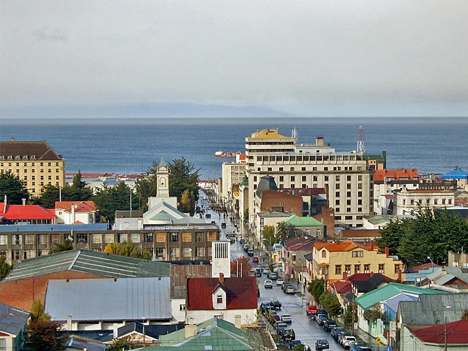
Punta Arenas
City guide · Magallanes y Antártica Region, Chilean Patagonia · Chile
Plaza de Armas with the monument of Hernando de Magallanes and a monument of a Magellan native, where local legend says touching the foot will bring visitors back to the city · Grand buildings from the late 19th and early 20th centuries, the golden age of the city
About Punta Arenas
Punta Arenas is the regional capital of the Magallanes y Antártica Region in Chilean Patagonia, one of the southernmost cities in the world and the largest city in Chilean Patagonia. Located on the Brunswick Peninsula on the shore of the Strait of Magellan, it serves as an important starting point for trips to Antarctica and the Falkland Islands. The city was founded in 1848 and features grand buildings from the late 19th and early 20th centuries, reflecting its golden age of maritime commerce, oil extraction, and sheep breeding. Its Subantarctic climate is cold and rainy, with strong winds, and the summer months from December to March are considered the best time to visit. The city is compact and walkable, with an abundance of banks, shops, supermarkets, pharmacies, hiking gear shops, and a duty-free zone called 'Zona Franca'.
Who this destination fits
Highlights worth planning around
Strong fit
- Largest city in Chilean Patagonia with all kinds of facilities, including banks, shops, supermarkets, pharmacies, and a duty-free zone
- Important starting point for trips to Antarctica and the Falkland Islands
- Compact and walkable city center built around Plaza de Armas
- Rich history with grand buildings from the late 19th and early 20th centuries
- Served by Presidente Carlos Ibáñez del Campo International Airport (PUQ), the main airport of Chilean Patagonia, with flights from Santiago and other southern destinations
Tradeoffs
- Subantarctic climate is cold and rainy, with strong winds; weather can change rapidly, bringing rain, wind, and sun all in the same day
- Winter temperatures average below freezing, with nighttime lows of -15°C (5°F) common
- No road connection to Chile north of Patagonia due to icefields; travel by land requires crossing through Argentina
- No centralized bus station; bookings must be made at individual bus company offices
- Remote location makes air travel the main way to get there
Plan the trip
Best time to visit
Summer from December to March, when it's windy but average temperatures are around 9°C (48°F)
Planning lead time
Moderate planning time recommended due to remote location and need to arrange transport, especially for trips to Antarctica or the Falkland Islands
Decision factors
Getting around
Reachable by air via Presidente Carlos Ibáñez del Campo International Airport (PUQ), about 20 km north of the city, served by LATAM Chile, Aerovías DAP, JetSmart, and Sky Airline, with flights from Santiago, minor airports in southern Chile and Argentina, and the Falkland Islands. By land, there is no road connection to Chile north of Patagonia; travel requires crossing through Argentina. By sea, there is a ferry a few times a week from Porvenir in Tierra del Fuego, and cruise ships visit often in the austral summer. Within the city, it is compact and walkable, with taxis available for longer trips.
Trip Budget Calculator for Punta Arenas
Estimate your travel expenses based on duration, style & group size
Global planning baseline. Flights use a generic estimate.
* Commission may be earned from qualifying partner bookings.